The History of Puzzle Maps

When I first started working in the museum at APH in 2005, I’d often commandeer my young son and nephews to pad the numbers at our new education programs on Saturdays. If I didn’t watch closely, they would wander away from the program and back into the gallery and inevitably end up at the U.S. puzzle map. I understand that better now. We use the map at all sorts of public programs, and young or old, the puzzle map is addictive. You just can’t leave it unworked. APH has been making tactile maps for a long time.
APH Superintendent Benjamin Huntoon began making wooden relief maps in the basement of the Kentucky School for the Blind in the 1870s. We have a beautiful little map of South America that Huntoon probably carved by hand. Little changed in their manufacture for fifty years. In 1922, APH bought electric carving tools to speed the process, but the maps continued to require skill and tedious handwork.
In 1936, an article in the Courier Journal featured an interview with the foreman of the APH map shop, William J. Butler, who was working on a wooden model of a U.S. map to be used to “make a mold for experiments in compositions.” A date on the metal mold suggests the experiments were completed by 1939.
Production of relief puzzle maps almost doubled in the years between 1938 and 1944. By 1945, the desk-sized hard rubber relief map of the U.S. appeared in the APH catalog. A 1945 report on map work by Mrs. Hugh D. Johnson praised the APH dissected relief maps in general as the “ones most eagerly used by teachers and children alike,” and in specific “the special delight of all my classes is the desk-sized hard rubber relief map…”
Former employee Ron Gadson described the hard rubber process as the mixing of liquid rubber with a powdered binder, which resulted in a brown material. The casting was cut apart on a band saw and hand-painted. In the mid-1960s, APH began molding the map in plastic. A U.S. puzzle map of a different design was reintroduced in 2002, and that’s the one my son loved to work on.
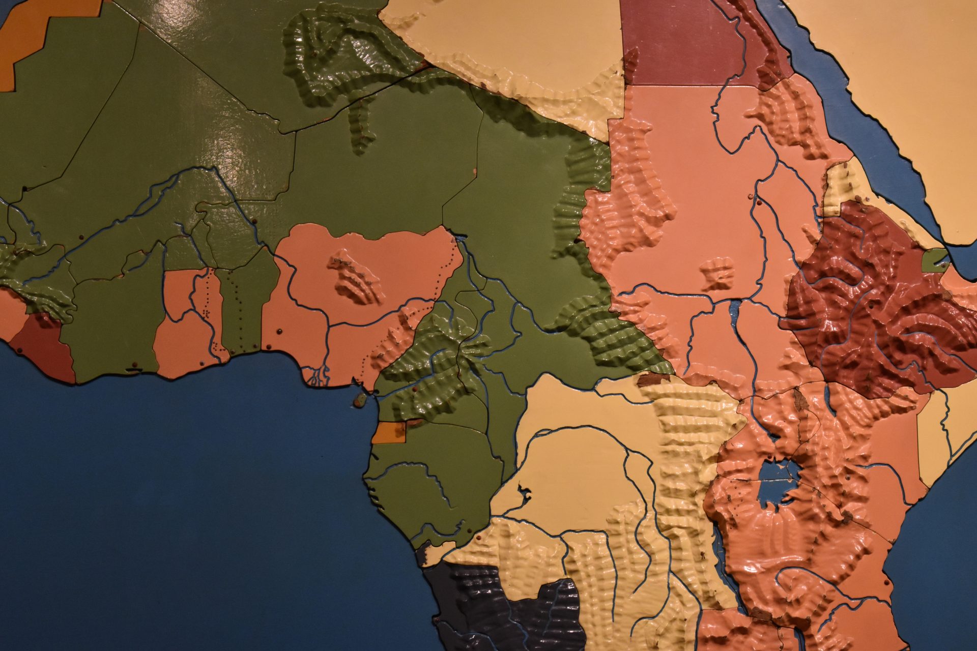
But my favorite is the big map of Africa we have on display. It’s a puzzle map too, meaning each piece is a different country, and each piece can be removed. The mountains are carved in relief, and the rivers and lakes are recessed. Each piece is painted a different color, depending on which European colonial power was in charge. When the map was made in the 1930s, Italy, Germany, England, France, and Spain all had colonial interests in Africa. Only Egypt, Liberia, and Ethiopia were governed independently. So these old maps are both a delight to the touch and a history lesson all in one.
Mike Hudson is the Director of the Museum of the American Printing House for the Blind.
Share this article.
Related articles

Running a Marathon: Moving a Museum Collection
With the Dot Experience at APH officially breaking ground, we have been incredibly busy behind the scenes preparing for construction...

Finding Sadie
“The blind veterans here in the Helen Keller class are able, thru talking books, to obliterate the tedious hospital hours...

The Kentucky School for the Blind Alumni Association Archive
In 2020, the Kentucky School for the Blind [KSB] Alumni Association signed an agreement that gave the care of the...
