Have the World at Your Fingertips with US Tactile Map
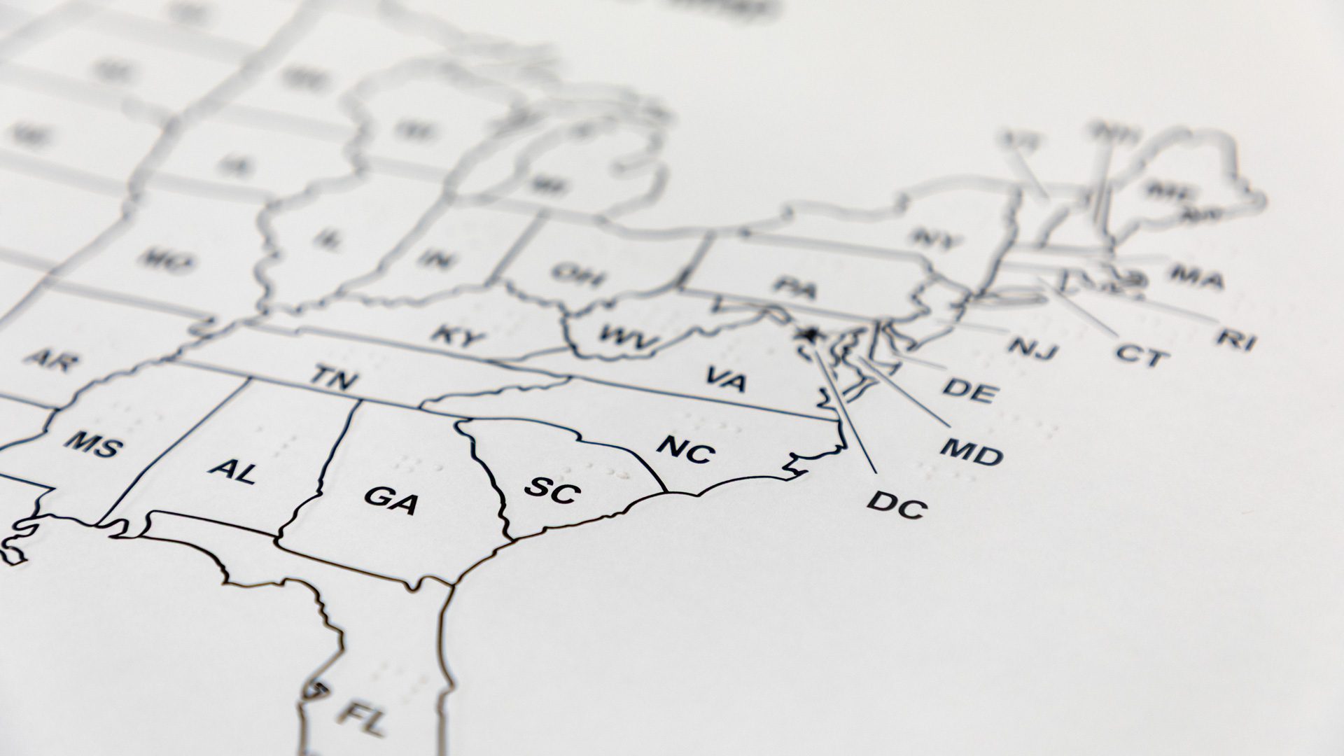
The US Tactile Map Classroom Pack is a carefully designed collection of 15 raised line paper maps of the United States. Along with the 15 maps, each pack includes a list of parts in both print and braille, as well as a key detailing the braille abbreviations for each state paired with the capital. The downloadable guidebook rounds out the pack as a way to ensure users have clear directions for use of the map, details on scaling of states, and an explanation of the layout. The guidebook comes with a list of suggested uses like classroom activities, paths across the map for students to follow, and more.
Designed for the classroom, each one of the maps is set up for individual student use. The inclusion of labels in both print and braille and in black and white font makes the maps easy to use for both sighted students as well as those who are blind or low vision. With this pack, teachers can purchase one map pack and have an accessible classroom tool for all students. Students who are blind or low vision don’t require their own specific map and lesson plans can be designed easily from the same source. Using the same maps also creates an easier opportunity for classroom collaboration. “Early exposure to maps prepares students for future learning, builds spatial awareness, encourages curiosity of the world, and strengthens memory and recognition. This raised line map with print and braille can be used alongside peers of all abilities,” said APH’s Product Manager, Laura Zierer.
Zierer, the Product Manager who developed the US Tactile Map Classroom Pack, has taken her work in accessible geography a step further with a partnership between APH and the North American Cartographic Information Society (NACIS). As NACIS developed the details for their upcoming Annual Meeting this fall in Louisville, a professor working with the organization reached out to APH hoping to showcase accessible geography products and resources.
A team from APH, including Zierer, will be presenting on tactile maps designed specifically for the blind or low vision population at the NACIS meeting on October 17. They will discuss the importance of correct tactile design choices, lead lines, and more. The team will also be bringing along products to showcase in the NACIS map gallery on October 15. They will be featuring maps like Tactile Town, as well as a map of the Galt House Hotel where the event is being held, to demonstrate the importance of spatial maps for orientation and mobility. APH will also be hosting field trip for NACIS attendees to show products, equipment, and molds used in the creation of tactile maps. Throughout the weekend the APH team hopes to demonstrate the importance of accessible geography and how accessible design can create a better product for all users.
To bring accessible geography into your classroom, you can purchase the The US Tactile Map Classroom Pack on the APH store now!
Share this article.
Related articles

Solid Light: Cynthia Torp’s Unique Model
We’ve been learning about the creation of The Dot Experience through the lens of the team at Solid Light. We...