
U.S. and Canada Tactile-Print Atlas
Get to know the United States and our northern neighbor better!
This product has been discontinued. We apologize for the inconvenience.
This product is discontinued.
Federal Quota Eligible
Catalog Number: 1-01920-00
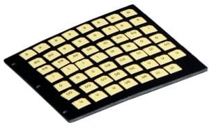
Product Description
The U.S. & Canada Tactile/Print Atlas is a reference volume of thematic maps for use in geography, history, or social studies classes in middle grades or higher, or for general informational use outside the classroom.
Each page spread has a combined braille and print key paired with a print map in contrasting colors and a clear tactile overlay. The maps are held in a three-ring binder, so pages can easily be removed as needed. The page size is 11.5 x 11 inches, with some larger maps presented as foldouts.
Included Maps:
● North America
● Canada and the U.S. – Major Cities
● Canada and the U.S. – Land Regions
● Canada and the U.S. – Elevation
● Canada and the U.S. – Climate
● Canada
● Canada – Western Provinces
● Canada – Eastern Provinces
● The Unites States (foldout)
● Northeastern United States
● U.S. – Rivers (foldout)
● U.S. – Economy (foldout)
● U.S. – Northwest (two pages)
● U.S. – Southwest (two pages)
● U.S. – Midwest and Great Plains (two pages)
● U.S. – South (two pages)
● U.S. – Middle Atlantic
● U.S. – Middle Atlantic Coast
● U.S. – Northeast
● U.S. – New England Coast
● U.S. – Alaska
● U.S. – Hawaii
-
Weight: 3.95 lbs
Dimensions: 13.5 × 11.5 × 2.5 in
Federal Quota Funds: Available
Age: 11 years and up
-
Contact Customer Service to discuss your warranty options.
Other Products
Word PlayHouse: Vowel Cards with Storage Panel
Replacement item for Word PlayHouse Kit: 1-03562-00. Note: This product has been discontinued. Orders will be fulfilled until inventory is…
$64.80
Catalog Number: 61-370-002
Replacement Item
Federal Quota Eligible
product
This product is discontinued.
Word Playhouse: Consonant Cards with Storage Panel

Replacement item for Word PlayHouse Kit: 1-03562-00.
Catalog Number: 61-370-003
Replacement Item
Federal Quota Eligible
product
Nearby Explorer
This app is no longer available for purchase and has been discontinued. We recommend downloading Goodmaps Explore and Goodmaps Outdoors…
Get Software
Catalog Number: D-30027-AP
Federal Quota Eligible
product